Darlington Borough Council's ward boundaries are being redrawn to ensure councillors represent roughly equal numbers of electors and to help the council work more effectively.
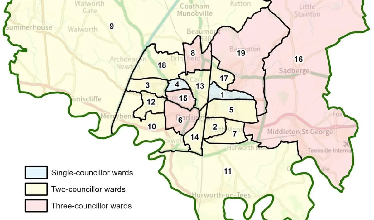
The Local Government Boundary Commission, an independent body, has published its final recommendations following a review of Darlington. Under the new arrangements, the borough will be represented by 41 councillors — 9 fewer than current numbers. These councillors will cover 19 wards: 5 three-councillor wards, 12 two-councillor wards and 2 single-councillor wards. Most ward boundaries will change, though one ward will remain unchanged.
How local feedback shaped the proposals
The Commission received 208 comments from residents and organisations during consultation. Bev Smith, Chair of the Commission, said: "We are very grateful to people in Darlington. We considered all the comments they gave us on our recommendations for a new electoral map for the area and this has helped us to make changes. We believe the new arrangements will deliver electoral fairness while reflecting the needs and identities of local communities."
Changes made in response to local input include splitting the draft three-member Albert Hill, Hundens & Red Hall ward into two wards divided by the Tornado Way. An area between Milbank Road, Woodland Road and Carmel Road North was included in a College ward to the south. Blackwell was grouped with Hummersknott following evidence of local community ties between the areas.
When the changes take effect
The new boundaries become law once Parliament approves them. Darlington Borough Council staff will implement the new arrangements in time for the 2027 elections.
Full details of the final recommendations are available on the Local Government Boundary Commission website at https://www.lgbce.org.uk/all-reviews/darlington